DAY 3: THE RAIN BEGINS

OMGRAIN
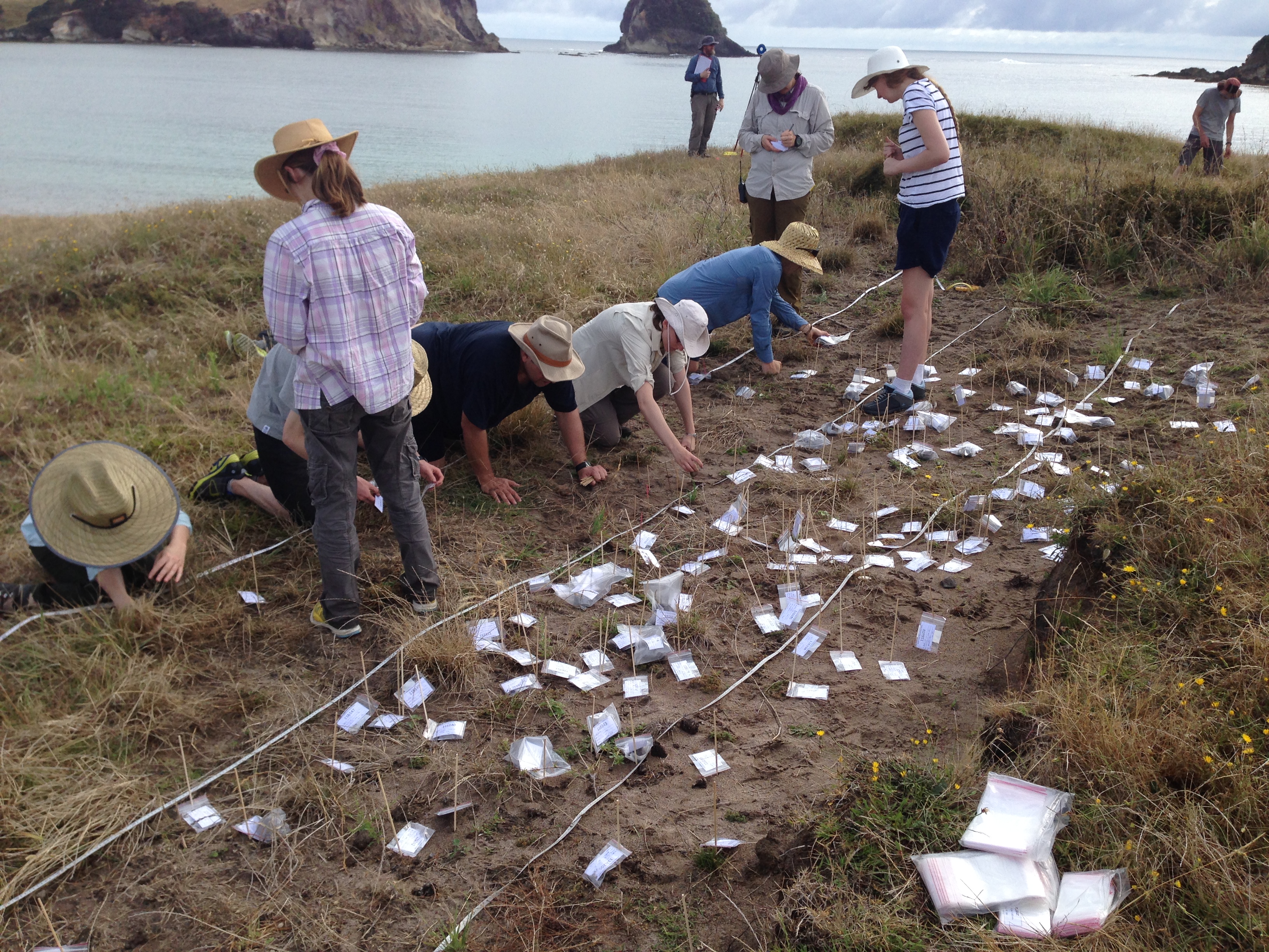
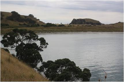
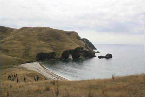
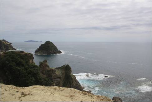
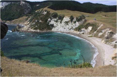
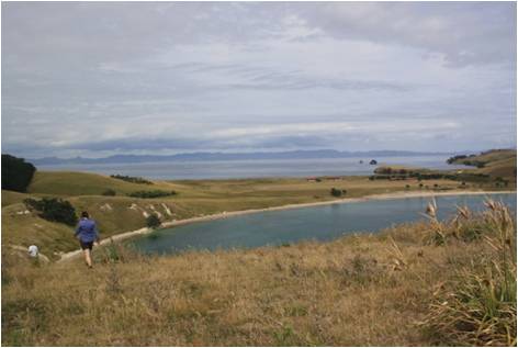
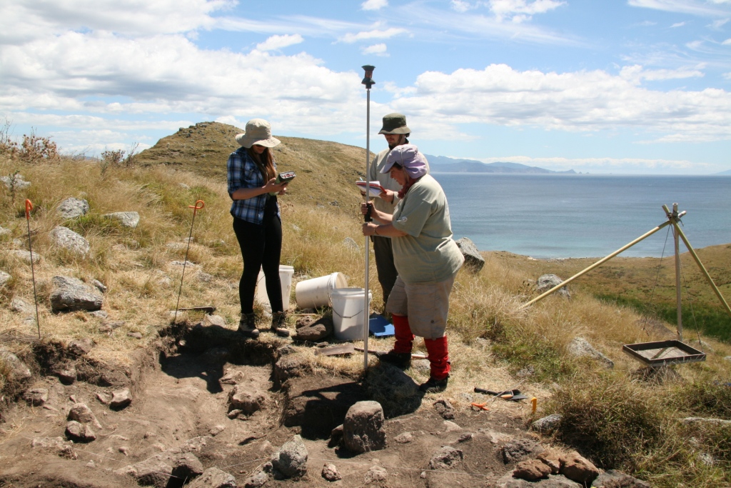
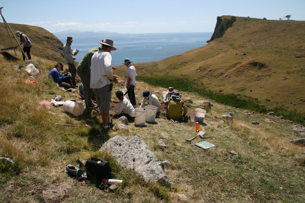
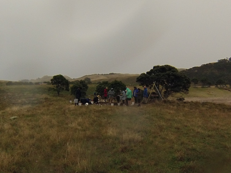
We began the day with a sleep in however short it may have been and reported for breakfast at 6.45am. By 7.30 am, Richard was still tired and complaining but we managed to depart on time for the field. Today, Kelly and Richard were stationed in EA64, continuing excavations on the main trench.  Richard worked on an area in the south-west corner of the trench and managed to find obsidian flakes, shell fragments and ochre.  Sieving of the excavated material revealed sheep poo, roots, and some smaller obsidian flakes. Kelly worked in the north-east corner, spending most of the day finding nothing until a rock revealed itself to be part of circular rock feature, which due to the abundance of charcoal in the centre indicates it may have been a fire feature. Zac found some potential post holes and half sectioning authenticated that Richard was out of his depth, but Zac was onto it.  Richard’s troweling technique needed some serious work and he cried while our senior tribal chiefs made an example of his poor method.  Luckily, there are ten more days for him to perfect the technique.  Using her magical powers of archaeology and deduction, Louise observed a depression in the north-west corner and the excavation area was extended by 1m by Logan.  Yet again, he found not a lot and is on the brink of being shunned from our island society (“the tribe has spoken”).  Louise herself began excavating the eroding sand dune to the north of the excavation area which we collected all the surface artefacts on day 1. Some interesting artefacts were found including a potential hangi (earth oven) and further excavation work is planned for the coming days.  Sarah and Rosa joined Josh for their first day of surveying using the Total Station aka the Wizard Stick.  We also surveyed some existing rock formations in the area surrounding the excavation site but for the most part, we shot in new deposit layers and artefacts located by the excavation team.  The rain hit mid-afternoon leaving Richard feeling wet and Kelly looking like she had spent a week in a coalmine.  Yet again, Richard cried.  We continued working in the rain with puddles in shoes and tears in our eyes, yearning for dry clothes and hot drinks. However, Kelly went swimming in the rain and Richard just wanted someone to hug him.  After showering/swimming/hugs, Kelly and Richard processed the day’s excavation photos and deposit forms from Day 1.  Sarah looked at the data with Josh that was surveyed throughout the day with the total station.  The smell of shepherd’s pie and plum crumble temporarily distracted us from our tasks and we’re all grateful for a hot meal tonight as the rain continues. Tomorrow, we look forward to more excavation and surveying and hope that this is the last of the rain.
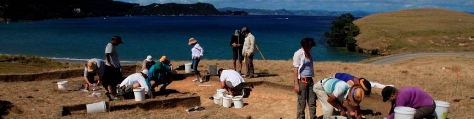
 

XOXO

Richard, Kelly and Sarah

Posted in Uncategorized | Comments Off on DAY 3: THE RAIN BEGINS

The Adventure Begins

Today marked the first proper day of work, here at Great Mercury Island. After a trek through long grass and sheep paddocks we made our way to Coralie Bay where we would be focusing our attention for this season.


We were all slightly weary after trying to adjust to the new habitat, but nonetheless eager to start finding out what we were in for. Divided we conquered the many tasks at hand. While one small group disappeared behind the main house into the dunes of Oneroa to survey, the rest formed into neat little packs to begin site preparation.


Surveying eroding artefacts

Surveying eroding artefacts

We did a resistivity test on a 20m by 20m area whilst others began identifying, marking, and labelling the multitude of exposed artefacts at the eroding dune face. It was pretty exciting actually discovering stone artefacts and fire-cracked rocks for ourselves! What was less exciting was thinking we’d found some fascinating stone artefacts which then turned out to be little presents left behind for us from our friendly neighbourhood sheep.


IMG_1013Meanwhile the survey team was learning why reception is an important part of archaeology. Still back at the main house, we were setting up the deceptively hard to pronounce Theodolite total station. This is a turret esc robotic laser surveying system, which tracks a prism on a stick to give you a map of artefacts or the layout of your excavation. We were crawling on our hands and knees combing the grass to find the mythical wooden peg which we would place the station over. Sitting on the previous year’s field school site we could spy on the main group roughly a kilometre away. We definitely did not contemplate lasering them. That would be an absurd notion. Setting up the triangulation point the station’s hand held device decided it wasn’t talking to the main Theodolite. We walked up and down a hill waving the hand held at the station, but even at point blank the Total station didn’t respond. Josh, the wizard of surveying, fixed it within two seconds. We were relieved, confused, and really itchy from the swarms of insects escaping the dunes. Once the points were set and we triangulated the main team’s location, we packed up the gear and carried it across the Tombolo of Great mercury island.


Back at Coralie Bay, the resistivity survey had shown an interesting anomaly that the dig team was going to investigate. After using Pythagoras’ theorem to create a perfectly square area (who’d have thought trigonometry would actually be useful!) we were on to de-turfing. Initially, this sounded fine. Then we began. As somebody who has never picked up a shovel in her life, I was in for a shock. I was given the run-down and demonstration by our supervisor who made it look way to easy. The first challenge was getting the spade to break the earth. Humiliation ensued. Eventually (and I do mean eventually) I got the hang of it, sort of. My poor body was not expecting such pain. As Emma so aptly put it, it was complete torture; so how were we still having fun? The de-turf did reveal a fascinating stone arrangement, so I know everyone is really excited to learn more about this. Worth it.


The main point of surveying arose as more and more artefacts were unearthed. We were late to the site because of the setting up process and there was a fair few little baggies for us to use our science on. The prism staff (also known as the wizard stick) has to be held perfectly level for the Total station to create a virtual map of all the locations of artefacts and trench walls. Every find required the position to be marked with a perfectly level wizard stick. The tiny little bubble in the level was afraid of being the centre of attention. We had a common train of conversation: ‘Ready?’ ‘One sec… Its steady.’ (Five seconds will pass). ‘Ok you can move the stick.’ By moving the stick it meant you could unlock your joints that were holding the staff hard against the wind and dusty ground. Suddenly we were the most popular people on site, moving from test pit to trench and back to our artefact scatter to try and get a few  done before our services were required. It turns out people aren’t amused when you say they are the third in the queue and could you please hold the line.


As a team, we ended the day with patchy sunburn, aching bones, splitting headaches, but all of this was cured by a swim in the sea and a chocolate pudding that was too good for words to describe.


Bring on tomorrow,

Hayley and Logan

Posted in Uncategorized | Comments Off on The Adventure Begins

Day 13 – Final day

Over the course of the blogs, have you ever wondered how many rocks actually make up our excavation site? Well, probably not, but we can tell you anyway! 1856, to be precise. How do we know this you may ask? Over the past two weeks there has been two total station teams shooting in (recording the specific point) every single rock in the immediate vicinity of the excavation areas.

Wait, we’re getting ahead of ourselves. Let us tell you about total station. It is a laser based survey device that allows us to record any point in a 3-dimensional space, through the use of a tripod and target pole. We can then look at the points using computer software, creating an overall map that we can add to each day.

As well as rocks, the total station teams shoot in artefacts, different soil deposits, cultural layers (the soil layer that cultural events occurred on), features like hearths or hangi, and the full excavation area. As you can imagine this would keep us very busy, and at times is quite stressful. Our reply to calls of ‘total station!’ was “stand by caller, your rocks are very important to us. You are next in the queue; we will be with you momentarily”.

This brings us back to our rocks. The aim of shooting in every rock was to map out the construction of the terraces, and see their relationship to the excavation areas. Through using the total station, we are able to digitally reconstruct the excavation site. This can then be used by field school students to aid in their research projects.

After 12 hard days of survey and excavation, our time was coming to an end. Everybody was running around frantically in order to complete everything on time. While the survey crew were shooting in the final rocks, the other teams were busy filling in the trenches we had so lovingly excavated over the past two weeks. While the final paperwork was being completed and the photos taken, chain gangs were formed to efficiently move the soil up and down to the trenches. By the end of the day you could hardly tell we were there.

All in all, it was a wonderful two weeks. We were surrounded by a beautiful landscape and terrific archaeology, but perhaps the most defining aspect of field school was working alongside such knowledgeable supervisors and directors, enthusiastic peers, and generally amazing people.

– Nick and Bailey

Posted in Uncategorized | Comments Off on Day 13 – Final day

A Continuation of There and Back Again: A Surveyer’s Tale

Today, I—Jennifer—embarked on an entirely expected journey.  This journey was that of the Surveying team lead by Zac.  Ever since arriving on Great Mercury Island and hearing the phrase “pedestrian survey” I was…mildly curious. And after hearing all the tales of the gruelling walks and the Lord of the Rings-esque nature of this activity, I was quite keen (as they say in New Zealand) to take part in this quest.  And since I had previously spent five days in a row on excavation, I knew my time in the realm of surveying was fast approaching.

And let me tell you:  It was certainly a journey.

We (Zac, Liam, and I) began by finishing up surveying the eastern coastline which took us up until a brief break at mid-morning.  This particular section of our quest was the section that everyone (except for Zac…so, really two thirds of us) was still enthusiastic about.  Although in retrospect, I think that Zac was excited in his own way.  However, he has seen there and back again and all that lies between so his enthusiasm is tempered by wisdom, sore muscles, and responsibility.  Perhaps a bit like Aragorn?  Gandalf?

But I digress.

I, on the other hand, was brimming with enthusiasm as we walked up and down steep hills that overlooked ravines like this:

GMIPan1JE


In fact, so enthusiastic was I that not even a botched jump over a patch of marshes that resulted in a soaking wet and smelly shoe could dampen my spirits.  After our mid-morning break, however, things became a bit more tiresome.  But still, my good spirits remained as we trekked up a particularly steep hill.  For whatever reason, I always managed to end up on the side of Zac as we surveyed our 25 meter transects that was uphill.  And even that fact failed to bring me down.

After all, the quest had just begun and we had much to show for it archaeologically.  We had located two particularly nice exposed sections of topsoil.  These showed a stark contrast in the naturally occurring topsoil, A-Horizon, and the cultural layer—the last of which was black in color and showed traces of charcoal deposits.  In addition to that, we had found many terraces.  The majority of these were narrower in size (perhaps a meter or so wide) which would have been used for gardening among the Maori people who once resided on Great Mercury Island.  Some of these were stone-faced which made identification of these terraces as easy as looking for horizontal or vertical patterns along the hillsides.  (See below for some brilliant examples.  Take note of the general goofiness of our resident Aragorn/Gandalf, Zac.)

Picture2


Picture3

See?  That’s quite a start to an adventure.  It took Bilbo Baggins ages to have his first truly exciting adventure with the trolls.  And knowing what you know now about cultural layers and terraces, I think it’s safe to say that we all know that an archaeological survey is way cooler than outwitting some trolls….

But then lunch hit.

Ah, lunch…the most devastating of blows to ones’ sense of perseverance.  It was at this point, where my stomach was full, the sun was annoyingly hot, and the landscape about us still left much to be “explored.”  Please note the use of quotation marks around the word explored.  That is an important bit of character development on my behalf designed to show my growing disillusionment with this so-called quest.

And so, with a weary heart, I began the second half of our journey.  This was more of the same—trekking uphill and downhill as we inched across the landscape.  But I was tired.  I was bitter.  I may have had the thought “Who’s dumb idea was this to survey these dumb hills?” once or twice.

But, around the time when my water bottle was slightly less than half full, I had a change of heart.  I realized that even Bilbo, a remarkable hobbit who had many fantastic adventures, must have had twice that amount of mundane and unpleasant moments as well.  But did he call it quits when his calve muscles were sore from walking along the Old Road?  No.  Did he think to himself “This sun is too bloody hot and these dwarves get on my nerves and I should just bugger off?”  Probably.  But the point is, despite all of that, he never gave up.  Because he knew that those aspects were part of a larger plan that would contribute to the overall success of his adventure.

Using Bilbo as my role model, I reached the same conclusion.  Just because surveying was gruelling and not quite how I had pictured spending a fair chunk of my time at an archaeology field school, doesn’t mean that isn’t important.  In fact, with the data Zac collects, the people leading this research experience will be able to determine which areas of the island were inhabited and with that knowledge, decide where to set up the future excavation sites.  That’s a huge deal!  And if I can be a part of it, and get to look at fantastic scenery (not to mention sing more than culturally accepted amount of Lord of the Rings theme song) along the way, then this is an adventure I am honored to take part in!

-Jennifer AKA Peregrin Took

Picture4

Posted in Uncategorized | Comments Off on A Continuation of There and Back Again: A Surveyer’s Tale

Day 7: Day Off!!!

Day seven, where to begin? It was our day off! It had been a hard seven days of wind, scorching sun and excavation on Tamewhera but now it was time to have a day off to see the beauty and the archaeological sites of Great Mercury Island. Although, despite the amazing descriptions given to the students about the beaches, views and the different pa the most excitement was when we were told that there was going to be a sleep in till 7.30am.


7.30 came way too fast as usual and before we knew it we were fed, watered (and coffeed!) and it was time to leave for our guided ramble of the tombolo (which is the flat piece of land that joins the north and the south ends of the island). With an air of excitement and curiosity we set off on our journey of the centre point of the island.

Our first stops were the old excavations of a garden terrace and an occupation site on the beach that were completed in the 2012 field school. Next on the tour was looking at the 2013 field school excavation sites; one of which was on the beach and the other on top of Stingray Point ridge. From there we were taken on to Stingray Point pa to see the terracing and other modifications but also where archaeologist Jack Golson undertook one of the first academic digs in New Zealand in 1954. 

Photo from eastern side of Stingray Point pa  across the tombolo to Motutaupiri Point pa

Photo from eastern side of Stingray Point pa
across the tombolo to Motutaupiri Point pa

The next stop was up and over a ‘hill’ down into one of the more recent excavations at Te Mataku where there have been many faunal, lithic and occupation finds. On Great Mercury Island most of the excavations are undertaken because the archaeology is at risk of being eroded away and if they are not excavated the information that could have been gained about the history of the island would be lost. Te Mataku is no different and what supports this is the amount that the beach landscape had changed from the time that we first knew about the site and when we visited the site today.

View down to Te Mataku

View down to Te Mataku

The last stop on the tour was Motutaupiri Point pa which was also up a large ‘hill’ and down another eroding hillside. The walk along the beach to the pa was a relaxing change where some decided to do away with their boots and socks for the feel of sand and water between their toes. Sadly another climb up a ‘hill’ was required to get to the top of the pa but the view was well worth it. The first sight we saw as we reached the summit of Motutaupiri Point pa was the sun reflecting off the Pacific Ocean right to the horizon.

View from the top of Motutaupiri Point pa

View from the top of Motutaupiri Point pa

View down into one of the bays from Motutaupiri Point pa

View down into one of the bays from Motutaupiri Point pa

We took in the view and ventured to the edge of the pa, which incidentally had steep drops down to the crashing waves on all sides. It truly was amazing to stand there and see the 360 degree view of the ocean then across the tombolo to Stingray Point pa

View from the top of Motutaupiri Point pa across the tombolo to Stingray Point Pa

View from the top of Motutaupiri Point pa across the tombolo to Stingray Point Pa

On the top of Motutaupiri Point pa was a sight to behold but there were a few hungry and grumbly tummies that needed to be fed so the descent off the pa began followed by a flatter walk across the tombolo to the shearers’ quarters for food. It was also important that the lecturers were back at the shearers’ quarters by midday so that they could be on time to pick up the new additions to the UoA GMI family; Liam, Louise and Nick as well as more supplies for the week to come.


The afternoon was rather relaxed and people spent it swimming, reading or baking. A few people got together to bake two carrot cakes, two banana loaves, two batches of ANZAC biscuits and some Afghans to the delight of everyone.

It was a brilliant but tiring day however it was worth it with the beautiful views, the knowledge that was shared and the realisation that this place has been used for hundreds of years. At the end of the day we all fell into bed with a sigh of relief and the question of what we might find tomorrow when we resumed excavation on the terraces of Tamewhera.

– Bailey


Posted in Uncategorized | Comments Off on Day 7: Day Off!!!

Mountains and Middens

More vegetation clearing!

More vegetation clearing!

So it’s definitely nothing like Indiana Jones or Time Team. It’s really dirty, it’s extremely hot, and it’s hard work – but it’s really enjoyable.

Today our team of three trekked out to try and make sense of the massive amounts of rock formations and terraces covering the hill at the Tamawhera site. Using GPS units with archaeological software, we marked out the exact position of terraces and stone features such as rock walls, alignments and terrace retaining walls. Unfortunately a large amount of these formations were covered by long grass and thistles, which meant our entire crew (excavators included) had to spend an hour each on the weed whacker in order to clear the formations. Our surveying team had to climb up and down the steep hill area many times over the day in order to get our eye in to some of the more difficult to see formations. These structures can tell us a lot about what archaeology may lie beneath the topsoil, and help us find potential housing, living, and gardening terraces.

Meanwhile, at the excavation site… Midden Man is a super-human entity, with a single purpose – to find midden. He can detect shell in up to 50cm of soil, which turns to annoyance as he realises he’s going to spend yet another day bulk sampling tons of shell. Seriously though, midden is important. It contains a wide variety of material that can help identify diet, environments, behaviours or the use of spaces. Finding and excavating it is fiddly and slow going but an interesting challenge as you attempt to define its extent while maintaining as much of the material as possible.

Archaeological work is hard, physically and mentally. Everyday has its own challenges from baking in the sun while digging, to hiking up and down the side of a large hill repeatedly attempting to identify features in a maze of stone. There are many opportunities to feel defeated, disappointed and generally exhausted. However when the alarm goes off at 6am, there is no hesitation in leaping out of bed and rushing into the field to continue your work. The excitement of finding a small window into the lives of those who have lived before us whether through a tool, a structure or a collection of midden material manages to overcome any exhaustion.

by Alex and Midden Man

Posted in Uncategorized | Comments Off on Mountains and Middens

Bits and bobs…

Today we once again woke to the familiar tones of an alarm, featuring the voice of a British lady who informed us that it was time to get up because it was 6 o’clock.

After the mad rush to make our lunches and jump in the van, we drove out to the drop-off point and began our trek up to the Tamawhera site. We have been excavating some trenches on the terraces, and our first job of the day was to remove the leftover topsoil from some of the excavation squares. The two of us were working in adjoining units on the lower terrace. The previous day had not uncovered many objects that caused excitement. However, this changed after the first few sifts of soil. We found two small (but still exciting) pieces of obsidian (volcanic glass) and fish vertebrate. These findings indicated that we were on the right track. Not long after this, our excavations showed a change in the archaeological layers.

Excavation progresses

Excavation progresses

In Victoria’s section, she initially noticed small scatterings of shell through the soil. When excavating these areas, large amounts of fish bone and complete shells were uncovered. Due to the high density of artefacts, a larger sample of the deposit was taken, which will be looked at on return to the lab at university. After this material had been removed and the last of the topsoil had been swept away, this section had finally reached the white clay layer of the original terrace. This terrace was in no way uniform, as we noticed a few darker areas coming through after dusting away the final bits of topsoil. These are currently thought to be post holes, which could possibly be a foundation for a house. Surrounding these post holes were also a few possible stake holes. This particular section can be summed up as having obvious occupation and an abundance of bones.

Lauren’s section of trench was very similar to Victoria’s. While removing the topsoil with a trowel, she and the other excavators discovered that the white clay was not smooth – there was a patch where the topsoil continued deeper. We excavated until Lauren’s unit was at the same level as Victoria’s. While digging out the topsoil, we also found some pieces of shell and fish bone, as well as a piece of obsidian. We did not dig further down into the dark patch of topsoil, but instead left it intact so that we could clearly see the contrast with the white clay. At this stage we are not completely sure what the patch represents, but it may be part of the structure in Victoria’s unit. By the end of the morning we completed the excavation in these squares and moved onto removing topsoil in the surrounding units to create a broader picture of the terrace.

Everyone worked hard in the afternoon heat. However, due to the draining conditions, we returned to the house half an hour earlier than usual to a well-anticipated swim.

This is Lauren and Victoria signing off from Great Mercury Island Field School, 2014.


Posted in Uncategorized | Comments Off on Bits and bobs…

My Struggles with Ingrid

Survey crew: Sherie, Josh, and Aimee

Survey crew: Sherie, Josh, and Aimee

My struggles with Ingrid started in a 35 km/hr wind, but perhaps I should start at the beginning. For Day 3 and 4, I’ve been working with Josh; taking measurements on a robotic theodolite, called Ingrid.  She’s a Total Station Leica T515, who swivels like a Darleck from Dr. Who.  Her handheld remote has an hour glass figure, but don’t let her dulcet tones deceive you: she can lie and be temperamental if not treated right.  Be nice. Basically treat her like she was dripping diamonds or a being with powerful connections to influential people.  When she is upset, she lets you know. A woman’s voice comes on; to beep at you or even scarier, she might say “locked to target”.

Embedded into her hour glass remote is some sophisticated software.  Unfortunately, I couldn’t see much of it in the glare of the sun.  Also, I brought the wrong kind of shades. It turns out my shades are great for the beach, but too dark for archaeology. So, it was hard to perceive subtle colour changes in the soil layers. It was also really difficult to read the remote touch screen properly. So, I kept hitting the wrong thing on the screen, causing my recording attempts to take longer.  Josh was very patient in correcting my errors.  Then tumbling around in between thistles and gorse (the only route to get from the drop off point to the site), I managed to break them.  Fortunately back at HQ, Rod brought out the ever trusty duct tape and fixed them. Eye protection is an equipment essential, here on Ahuahu / Great Mercury Island. Firstly, there is the fierce sun. Secondly, Ingrid emits a laser light to a prism on a pole to measure distance and points. This way the theodolite triangulates a third point from two known co-ordinates.

Speaking of the prism, it rests on a long pole. It’s really cool to look like Gandalf in Lord of the Rings, stalking innocent archaeologists with this huge wand thing, ready to zap in the location of any of the artefacts they find. The hard part is trying to keep the bubble in the level where it should be in high winds. On Day 3 I worked with Holly and Day 4 I worked with Aimee. We all rotate tasks at Field School, so we get to learn a little bit about the different aspects of archaeology in the field.

Our team took lots of readings of rocks, because there are numerous stone walls along the terraces on the site.  Some people seem to think that there is very little for archaeologists to do in New Zealand / Aotearoa. This couldn’t be further from the truth, as we are discovering from our investigations into Ahuahu / Great Mercury Island at Tamawhera.

Sherie Crosby


Posted in Uncategorized | Comments Off on My Struggles with Ingrid

THERE AND BACK AGAIN: AN UNEXPECTED JOURNEY

The first rays of the soon to be scorching sun cast their glow across the rugged landscape we would be traversing. We were a part of a fellowship. A fellowship with one aim: to survey the entire northern landscape of the island and note the presence of archaeological features upon it. Our leader and ranger Zac was armed with the tools we needed to complete (or attempt to) our task. These included, but were not limited to, a GPS (Global Positioning System) unit equipped with ArcPad software and an unsteady foot.  Accompanying our leader was a wizard of immense knowledge, brandishing both a glorious staff and ginger beard, going only by the name of Joe. Then there was us, an idiotic hobbit (Alex Bes) and an exasperated elf maiden (Sarah), both up to the task but unaware of its perils.

Figure 1: Because no-one took any photos of the Fellowship in action, here is an artist's impression of the day.

Figure 1: Because no-one took any photos of the Fellowship in action, here is an artist’s impression of the day.

Our journey began on the slopes of another hill north of, and running perpendicular to Tamawhera where those unworthy to be part of our fellowship toiled away, excavating under the sun. In order to achieve the momentous aim we had, we would divide the lands of the men into 25×25 metre grids. Following our leader, we of the fellowship trudged behind noting any features on the landscape. The first hill on which we traversed had many indicators of previous inhabitants. Prehistoric terraces dominated the landscape along with a number of stone alignments and earthwork features such as banks and terraces. We continued north of Tamawhera to the edge of the island. Thanks to a malfunction of the GPS unit we almost had to go all the way there, and back again ;). The fellowship was tested by the topographically shifting landscape of ridge, swamps and valleys, suffering only sore feet as a result.

Terrible analogies aside, our walking survey was most enjoyable and served a very important purpose. Previous large scale surveys of the island were conducted at a site-based level. By surveying at a feature-based level we were aiding Zac in creating a higher resolution map of the archaeological landscape. We were primarily interested in whether there was archaeology in the area or not as our main variable; this would help Zac further in his research when he plans to map out the GPS co-ordinates of the features we identified.

Signed on the thirtieth day, of the first month, of the two thousand and fourteenth year,

Bes and Sarah.


Posted in Uncategorized | Comments Off on THERE AND BACK AGAIN: AN UNEXPECTED JOURNEY

Day One – 29/01/14

Clearing thistles

Clearing thistles

We arrived on the island yesterday, taking a boat from Whitianga. Today, we woke up early. The sun had only just risen, Venus and the moon still visible in the sky. We had breakfast quickly and went up to Tamawhera Pa.

But before we could start excavating, we had to clear up the area. Clearing thistles under the hot sun was hard but rewarding work. The terraces on the hillside looked a lot clearer, and this also allowed more accurate digital recording of the larger site area.

Then the fun began! I was in a group excavating a possible house site on a terrace a few metres below the summit. A house site found on an excavated terrace in a previous excavation indicated that we might find something similar further up the hill. We set up the excavation squares and removed the turf, and then began to slowly excavate the topsoil.

Excavation begins

Excavation begins

It wasn’t long before we found some interesting things, like stone cores and flakes of obsidian and chert. There’s nothing quite like brushing away soil and uncovering the oily black surface of an obsidian flake, or a pearly shard of chert. Most of the work was removing soil carefully, with small trowels and brushes, and sieving the soil to check of small or overlooked artefacts.

Terraces at Tamawhera are distinctive because they are faced with stones, and the view from the top of the hill down at tear-drop shaped terraces one below the other is intriguing. I could imagine people living there in the past, surrounded by beautiful scenery.

At the end of the day we returned to the shearing quarters, hot, sweaty and very dirty. And then, we walked over the hill for a dip in the sea. The water is clear and calm, an impossible turquoise next to the white sand. The sun’s just set, and soon it’ll be time to go to sleep, so we can wake once more with the sun, ready for another exciting day.

I’m really enjoying this fieldtrip, and I’m looking forward to what the next two weeks will bring.

–          Jenny Loader

Posted in Uncategorized | Tagged , | Comments Off on Day One – 29/01/14