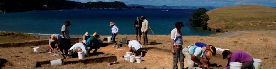
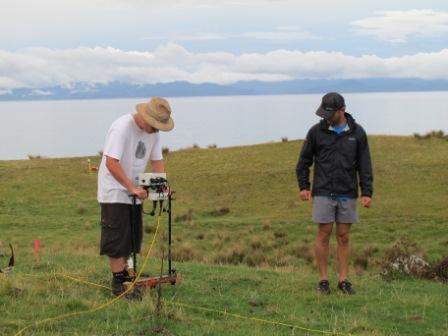
 The geophysics team studied a 20m2 area on a terrace above the rock gardens under excavation. Geophysics is a non-intrusive survey technique that allows us to have a picture of what is underneath the ground without having to dig it up. This allows us to target good spots for later excavation. We began by marking out a square 20m2 grid aligned to magnetic north. Following this we used a fluxgate gradiometer to study the resistivity of the ground. This testing shows what may be concentrations of water in infilled storage pits (low resistance) or rock alignments (high resistance) beneath the topsoil. We found a line of high resistance along the western edge of the terrace, suggesting a possible rock wall. In the centre of our 20m2 there is a 2nd terrace level which shows a lower resistivity, suggesting different soils between the two levels. After the resistivity testing we used a magnetometer to study the magnetism of the ground. High magnetism may mean remnants of burning are below the surface, such as a hearth, while lower magnetic readings suggest undisturbed soil. Our results show a slow gradation of magnetism below the surface, reflecting the contour of the slope. There are some anomalies, though are rather small, that may require further investigation. We are about to extend the area 20m southward to further study the difference between the two terrace levels, where there is a sharper ridgeline.
– Zac
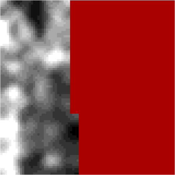
Example of first resistivity survey – dark areas equal low resistivity, light areas equal high resistivity.